| dc.contributor.author | Lader, Pål | |
| dc.contributor.author | Kristiansen, David | |
| dc.contributor.author | Alver, Morten | |
| dc.contributor.author | Bjelland, Hans Vanhauwaert | |
| dc.contributor.author | Myrhaug, Dag | |
| dc.date.accessioned | 2017-09-29T16:46:13Z | |
| dc.date.available | 2017-09-29T16:46:13Z | |
| dc.date.created | 2017-09-29T13:19:40Z | |
| dc.date.issued | 2017 | |
| dc.identifier.citation | ASME 2017 36th International Conference on Ocean, Offshore and Arctic Engineering: Volume 6: Ocean Space Utilization | |
| dc.identifier.isbn | 978-0-7918-5772-4 | |
| dc.identifier.uri | http://hdl.handle.net/11250/2457573 | |
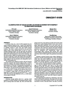
| dc.description.abstract | In Norway there are a total of 1070 registered sites for salmon farming all along the coast. Trends in the aquaculture industry in the recent decade are that salmon farming sites tend to gradually relocate to more wave and current exposed locations. This trend is mainly motivated by the good water quality found in more exposed areas, as well as a lack of available sheltered locations. On the other hand, the increased exposure puts higher loads on the structures and this needs to be addressed by the development of more robust technology. The first step in order to address an increased exposure is to quantify the level of exposure of waves and current, and in this paper a method to easily estimate the level of wind wave exposure on a large number of sites are presented, and subsequently used to analyse all Norwegian sites.
The method can be called fetch analysis, and use long term wind data connected with the fetch length in order to estimate wind wave conditions. The method is divided into four steps: 1) Fetch analysis, 2) Wind data, 3) Estimating wave parameters Hs and Tp and 4) Wave statistics. Significant wave height Hs with return period 1 year and 50 years are estimated for each site. Hs 50 year is often used for design, and the analysis shows that for 38% of the sites Hs 50 year exceeds 1 meter, for 17% of the sites Hs 50 year exceeds 1.5 meter, while 1.4% of the sites have Hs 50 year larger than 2.5 meter. The most exposed site has a Hs 50 year of 2.9 meter. Thus there are large differences in Hs 50 year in the various coastal regions of Norway. | |
| dc.language.iso | eng | nb_NO |
| dc.relation.ispartof | ASME 2017 36th International Conference on Ocean, Offshore and Arctic Engineering - Volume 6: Ocean Space Utilization | |
| dc.relation.ispartof | | |
| dc.relation.ispartofseries | ASME Digital collection;OMAE2017-61659 | |
| dc.rights | Navngivelse-Ikkekommersiell-DelPåSammeVilkår 4.0 Internasjonal | * |
| dc.rights.uri | http://creativecommons.org/licenses/by-nc-sa/4.0/deed.no | * |
| dc.title | Classification of Aquaculture Locations in Norway With Respect to Wind Wave Exposure | nb_NO |
| dc.type | Chapter | nb_NO |
| dc.description.version | acceptedVersion | nb_NO |
| dc.rights.holder | Copyright © 2017 by ASME | nb_NO |
| dc.identifier.doi | 10.1115/OMAE2017-61659 | |
| dc.identifier.cristin | 1500437 | |
| cristin.unitcode | 7566,3,0,0 | |
| cristin.unitname | Havbruksteknologi | |
| cristin.ispublished | true | |
| cristin.fulltext | postprint | |
| cristin.qualitycode | 1 | |

